World Fish Migration Day in Connecticut

Migratory fishes include the diadromous species that move between freshwater and saltwater and back to spawn are critically important to our ecosystems, our economies, and our quality of life. They were hugely important to Native Americans and early colonists of Connecticut but were decimated by the construction of dams, which blocked the migrations. Many groups are working together to restore runs of migratory fishes. Learn more and see the fishways that have been built to get fish around dams. And visit a site where a dam was removed. Come see how beautiful the restored site is. Below are the descriptions to fourteen sites where events will be held on World Fish Migration Day, April 21, 2018. The accompanying map shows their locations in Connecticut. Unless otherwise stated, the events will occur from 10 am until 3 pm. Please check the following descriptions carefully for times.
All events are free of charge and family friendly.
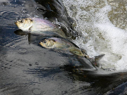
This year, World Fish Migration Day closely aligns with the migration of Alewife, a native river herring in Connecticut.
If you intend to be in another state or even another country, visit https://www.worldfishmigrationday.com/ to learn where events will occur.
Organizing groups:
In association with many other fine conservation organizations, municipalities, and businesses.
Connecticut sites where events will be held on World Fish Migration Day, April 21, 2018:
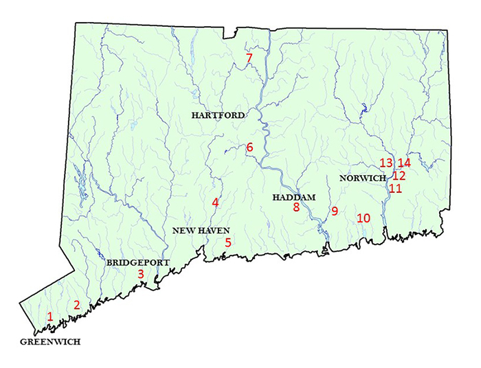
The 14 Connecticut sites:
- Mianus Pond Fishway (Greenwich)
- Norton Culvert Fishway (Stamford)
- Bunnells Pond Fishway (Bridgeport)
- Harry Haakonsen Fishway at the Wallace Dam (Wallingford)
- Branford Water Supply Pond Fishway (Branford)
- StanChem Fishway (Berlin)
- Rainbow Dam Fishway (Windsor)
- Eagle Landing State Park (Haddam)
- Ed Bills Pond Dam Removal site (Lyme)
- Latimers Brook Fishway (East Lyme)
- Hallville Pond (Preston)
- Greeneville Dam Fishlift (Norwich)
- Taftville Dam Fishway (Norwich)
- Tunnel Dam Fishlift (Preston)
 #1 — Mianus Pond Fishway (Greenwich)
In the Cos Cob section of Greenwich.
This dam and brick building were built for a power plant to support the old electric railroad nearly 100 years ago. Now the building is an adult day care center and the Town built a steeppass fishway, which allows Alewives to go upstream and gain access to important spawning and nursery habitat in the Mianus River. There is an electronic fish counter and eel pass at this site, as well. The fishway is operated by the Town’s Conservation Commission.
During the open house, participants will be given a tour of the fishway and learn about its history, the natural history of the fish that utilize it, and how it is operated. No prior knowledge of fish migration and passage is needed to attend. Local residents, fishing groups, environmental organizations, watershed associations, and town employees are encouraged to attend
121 River Road Ext., Cos Cob, CT 06807
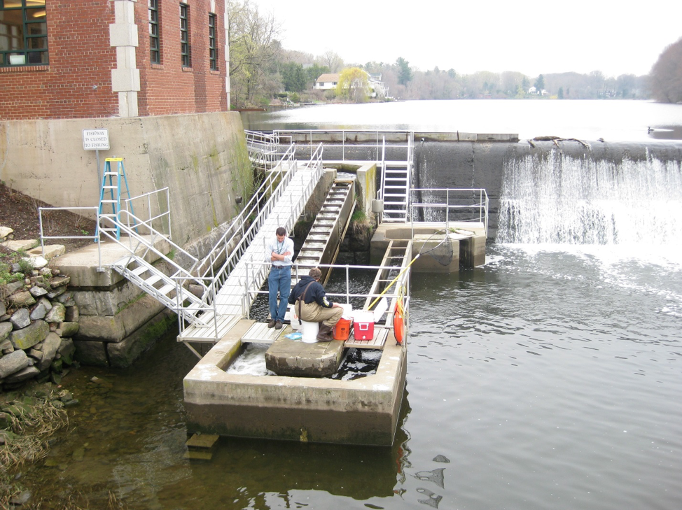
Biologists often dipnet into the resting pool of the Mianus Pond Fishway to sample the river herring run to distinguish between Alewife and Blueback Herring.
#2 — Noroton Culvert Fishway
Located on the border between Darien and Stamford.
This will be the newest fishway on the World Fish Migration Day schedule because it won’t be done until early April. Dams are not the only things that block fish migrations. Poorly designed and built culverts can stop fish, too, like this circa 1950s culvert under Interstate 95. Working with the State DOT (which owns the culvert), Save the Sound/Connecticut Fund for the Environment put together a team to build a rock ramp style fishway that gets fish up over the lip of the culvert. The fishway was designed by Princeton Hydro (engineers) and built by Schumack Engineered Construction. Inside one of the culvert boxes is a series of high density plastic off-set baffles. If you want to see those, bring hipboots! While this fishway can be seen throughout the open house hours of 10 am to 3 pm, the best viewing will be during low tide, before 1 pm.
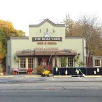
1308 East Main St., Stamford, CT 06902. Park behind The Boatyard Barbeque restaurant, who graciously has allowed this one-time visitation. They also serve good barbeque!

-
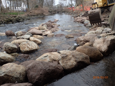
- The Rock Ramp fishway below the culvert is still under construction but will be done in time!
-
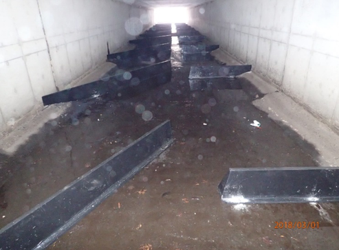
- These off-set baffles create localized hydraulics that let fish swim through this box culvert that is flat side-to-side but sloped end-to-end
#3 — Bunnells Pond Fishway
Next to Beardsley Zoo in Bridgeport.
This 23’ tall dam on the Pequonnock River used to supply drinking water to Bridgeport but now is part of the City-owned park. The dam and fishway are owned by the DEEP. Staff at the Zoo assist the DEEP’s Fisheries Division with monitoring the fishway for fish runs. The steeppass fishway is believed to be the tallest steeppass fishway on the East Coast of North America and has several resting pools for the fish on their way up. Look for black-crowned night herons below the fishway and cormorants above the dam. The strong run of Alewives has attracted many fish-eating birds. There is an underwater camera and during the season, it is live-streamed to the internet. This open house is hosted by Connecticut’s Beardsley Zoo as part of their day-long event: The Pequonnock River Festival, with nature walks featuring the fishway. There is also a small fishway about a ¼ mile downstream of the dam in Glenwood Park at the intersection of Glenwood Ave. and Boston Ave., which can be observed on one’s own. This is best appreciated before the higher tidal stages, around 2 pm.
1875 Noble Ave, Bridgeport, CT 06610. Enter the Zoo and look for signs.

There is a camera at the top of the Bunnells Pond steeppass fishway to record the number of fish that pass upstream. Beardsley Zoo is on the other side of the dam.
#4 — Harry Haakonsen Fishway at the Wallace Dam
Near the Wilbur Cross Parkway in Wallingford. (Number 4 on the map.)
This old mill dam is only four feet high but that’s enough to stop shad and river herring from going upstream. Save-the-Sound/Connecticut Fund for the Environment built this Denil fishway with an underground window and camera and the DEEP operates it and compiles run counts from the video. There has been a lot of work in this watershed to improve and reconnect the habitat. This fishway, named after a professor, conservationist, and Wallingford resident, is the gateway to the watershed for migratory fish.
3 River Road, Wallingford, CT 06492. This site does not have a formal address but this is approximate. It is at the west end of Quinnipiac Avenue.
During the dedication several years ago, volunteers planted shrubs alongside the Haakonsen Fishway.
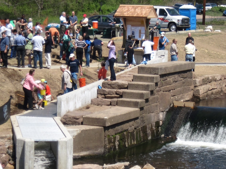
#5 — Branford Water Supply Pond Fishway
Located in a Town Park just north of I-95. (Number 5 on the map.)
This Town-owned dam is on Queach Brook, a tributary of the Branford River and there are more natural ponds upstream of this impoundment, all of which are good Alewife spawning and nursery habitat. The fishway is owned and operated by the Town of Branford with assistance from the Branford Land Trust. The DEEP Fisheries Division operates an electronic fish counter at the site. The fishway is lined with beautiful quarried granite blocks, donated by a Stony Creek quarry.
29 Short Rocks Road, Branford, CT. This address is approximate. Look for signs. Pull off to the side of the road and walk down short path to the dam.
Water from the dam drops over a lip of rocks that fish cannot surmount. They find the nearby entrance to the fishway and enter. There is a resting pool halfway up.
#6 — StanChem Fishway
Located in the East Berlin section of the Berlin, CT. (Number 6 on the map.)
This is at the first dam on the Mattabesset River, a Connecticut River tributary. For years, workers at the local chemical manufacturing plant watched fish pile up below the dam and wished they could do something about it. After many years of planning and design, The Nature Conservancy built a Denil fishway around the dam to allow shad, river herring, Sea Lamprey, trout and many other species access to nearly 50 miles of habitat. And another fishway at the next dam in Kensington is currently being planned. This fishway has an underground counting house where visitors can go down and watch fish swim past a viewing window. There is also an innovative buried eel pass.
401 Berlin St, East Berlin, CT 06023


Wooden baffles slow the rush of water to allow fish to ascent the upper section of the StanChem Fishway. At the top, the fish swim past a viewing window and get their picture taken.
#7 — Rainbow Dam Fishway
Poquonock section of Windsor near Bradley Airport. (Number 7 on the map.)
This is the highest fishway in Connecticut and one of the highest in New England. The 59 foot high Rainbow Dam is the first barrier on the Farmington River, just eight miles up from the Connecticut River and is owned by StanleyBlack&Decker of New Britain for generating electricity. The vertical slot style fishway is owned and operated by the DEEP Fisheries Division. There is an underground viewing window where visitors can watch migrating fish swim by and this is one of the few places outside of Maine where Atlantic Salmon still return. This year’s event is a bit too early to see American Shad and Sea Lamprey but Alewives, trout, White Suckers and maybe a salmon will be running. Tours of the fishway and the hydroelectric powerhouse will be provided and the Connecticut River Salmon Association will be on hand to discuss the life cycle of the Atlantic Salmon and tell about their popular Salmon in Schools program in which participating schools get 200 salmon eggs to incubate, hatch, and stock.
401 Rainbow Road, Windsor, CT – look for the sign at the gate. Drive in and park in the upper parking lot and walk down along the fishway to the inner gate

-
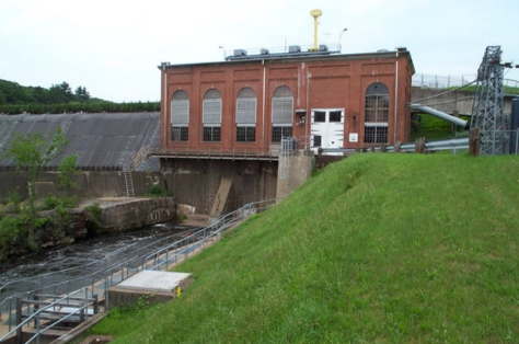
- The dam to the left sends water through the brick powerhouse to generate electricity. The entrance of the fishway (flanked by the gray railings) is at the base of the powerhouse. The fishway exit is behind the powerhouse, above the gray pipe to the right.
-
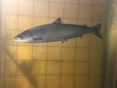
- An adult salmon fresh from the ocean in 2017 lingers in front of the viewing window.
#8 — Eagle Landing State Park
Located in the Tylerville section of Haddam, on the Connecticut River by the East Haddam Bridge. (Number 8 on the map.)
This is not a dam site but a park alongside one of the East Coast’s premier migratory fish rivers, the Connecticut. Exhibits, hand-outs, live fish displays, a release of Alewives, talks and presentations will be made here beginning at 9:00 am. Directions to all other events will be provided. This is envisioned as a kick-off spot for all the day’s events. Come learn about migratory fishes, consult maps, and strike out to other World Fish Migration Day events elsewhere in the state.
12 Little Meadow Road, Haddam, CT 06438. This is not a precise address but this will get you to the area; look for signs. This main road is just on the Haddam end of the East Haddam Swing Bridge.
![]()
-
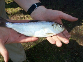
- An Alewife
-
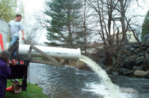
- Releasing Alewives from a truck (which we’ll do here at 10 am).
-
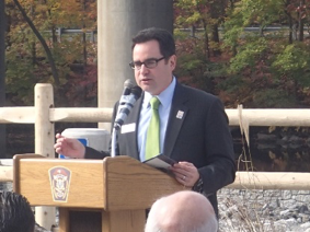
- Commissioner Rob Klee (who will address visitors at the State Park)
-
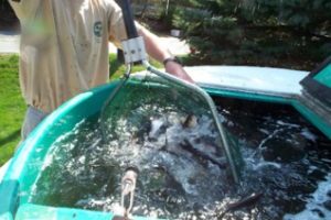
- Netting Alewives
-
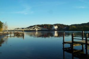
- The view from Eagle Landing State Park
-
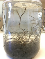
- Glass phase American Eels (which we’ll have on hand)
#9 — Ed Bills Pond Dam Removal site
In the North Lyme section of Lyme, CT. (Number 9 on the map.)
What’s more effective at getting migratory fish upstream than fishways? Removing the dam! You may not see the fish, the river has been restored to a natural state with great quality habitat. The Nature Conservancy removed this privately-owned dam on the East Branch of the Eightmile River three years ago and will be on hand to show visitors how both the stream and the streambanks have rebounded and reverted toward their historic conditions. The stream is healthy and beautiful and not only is the free-flowing stream now full of trout but anadromous Sea Lampreys are spawning in the gravel where a muddy pond used to be. This is located within a national Wild and Scenic River system, the Eightmile River.
14 Salem Road, Lyme, CT 06371. Parking is limited. Look for signs.
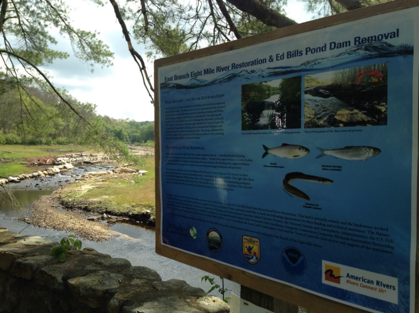
Learn about the benefits of dam removal at Ed Bill’s Pond in Lyme. That scenic stream in the background is flowing where a muddy, biologically-impoverished pond used to be.
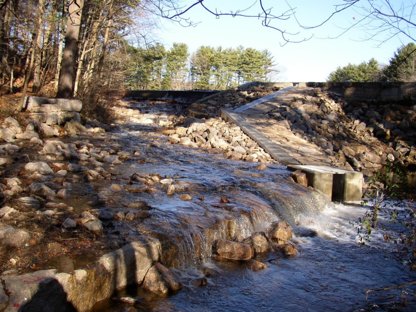
#10 — Latimers Brook Fishway
Flanders section of East Lyme. (Number 10 on the map.)
This is one of the oldest fishways in Connecticut, dating back to the 1960s. It was built to pass sea-run trout and Alewives and has a manually-operated trap at the top to allow biologists to capture trout. There is also an electronic fish counter at the exit of the fishway. Even if the Alewives are not currently running, there are often dozens stacked up below the fishway, waiting for nightfall to ascend the fishway. This steeppass fishway is owned and operated by the DEEP’s Fisheries Division.
77 Boston Post Road, East Lyme, CT 06333. This location has no official address so this is approximate. Look for the sign on the side of the road.
![]()
This steeppass fishway is in the shadow of Interstate 95.
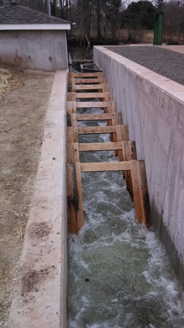
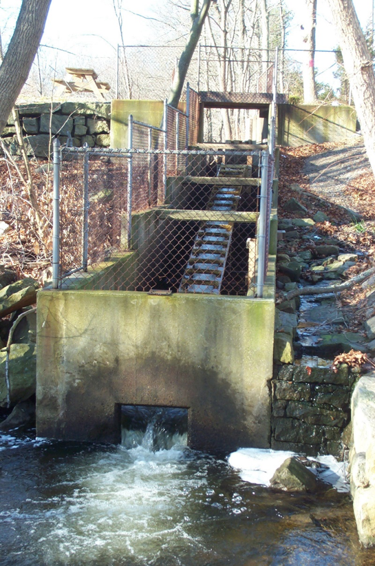
#11 — Hallville Pond
In the Hallville section of Preston. (Number 11 on the map.)
This is a steeppass fishway at the first dam (privately-owned) on Poquetanuck Brook. It was built by the Eastern Connecticut Conservation District as part of a project to mitigate for the loss of fish habitat elsewhere in the watershed. The fishway, operated by the DEEP, has a video camera with an underground/underwater window and an eel pass. This is a great site for walking all around the fishway and inspecting all parts of it and even sticking your hands in the water, if you wish.
37 Rt. 2A, Preston, CT 0635.
The entrance of the Hallville fishway is below the base of the dam. A steeppass ramp brings fish up to an intermediate resting and turn pool. An upper ramp takes the fish up to the exit where they pass an underground window. The gray pipe is part of the eel pass.
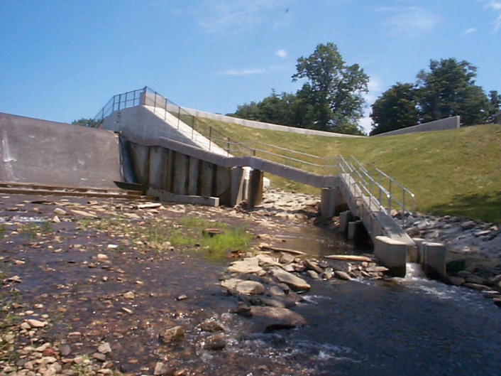
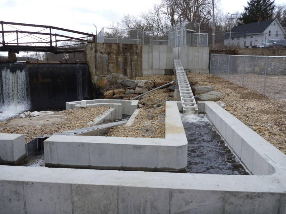
#12 — Greeneville Dam Fishlift
Located in the Greeneville section of Norwich, CT. (Number 12 on the map.)
Greeneville was once a manufacturing giant in the state but the dam that powered the mills also blocked fish migrations. When the mills went out of business, the City of Norwich acquired the dam to generate electricity for its residents. When the project underwent relicensing in the late 1990s, the City built this fish lift (or elevator) to pass American Shad and river herring upstream. Visitors will be able to see the elevator capture and lift fish and run down to the counting house and watch those same fish subsequently swim past a large viewing window as they move upstream.
7 8th Street, Norwich, CT 06360. The entrance is behind an abandoned warehouse; look for signs.
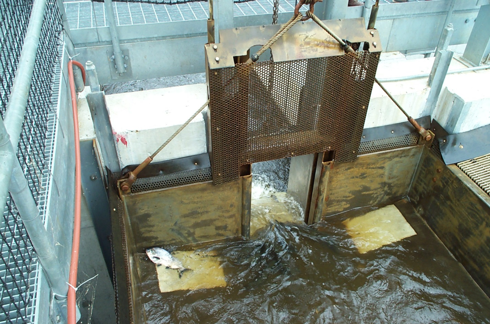
When the hopper full of water and fish reaches the top, the gate automatically opens and the contents spill down into a channel. Here, one last shad resists the inevitable pull of the draining water.
#13 — Taftville Dam Fishway
Located in the Taftville section of Norwich, CT. (Number 13 on the map.)
This dam operated the Ponemah Mill, the largest textile mill in the nation during the Civil War. The old mill building is being renovated for condos but FirstLight Power Resources has generators in lower level to generate electricity. They built a Denil fishway to let fish get past this dam, which is the next dam upstream from the Greeneville Dam. Underwater cameras monitor the movement of fish through the fishway. This fishway is rarely open to the public so this is an unusual opportunity.
THIS OPEN HOUSE WILL RUN FROM 1:00 TO 3:00 PM.
299 Taftville-Occum Road, Norwich, CT 06360

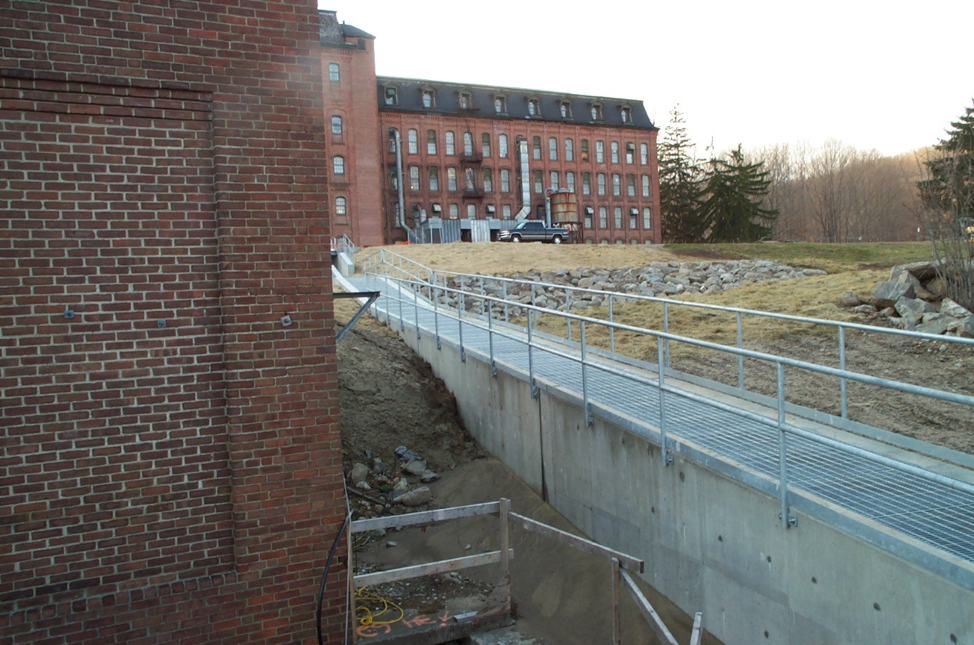
The Taftville fishway winds around a small hydroelectric powerhouse. The fishway exit is barely seen in the background. The entrance is located to the left of this photo.
#14 — Tunnel Dam Fish Lift
Located in a remote section of Preston. (Number 14 on the map.)
This dam got its name from its proximity to one of the nation’s first railroad tunnels, which can be seen on the far side of the river from the powerhouse. This powerhouse is used by owner First Light Power Resources to generate electricity. FirstLight built this fish lift (elevator) in 2007 at this first dam on the Quinebaug River, less than a mile upstream from where the Quinebaug enters the Shetucket River, in between the Greeneville and Taftville dams. After the fish are released from the hopper, they swim past a window located in the counting house seen as the little hut in the photo below. Visitors can watch the lift operate and see the fish swim past the window as well as view the facility’s eel pass (waterproof shoes and an umbrella would be advisable for those wishing to see the eel pass). This is another rare opportunity to see a fishway that is not normally open to the public.
THIS OPEN HOUSE WILL RUN FROM 1:00 TO 3:00 PM.
98 Roosevelt Ave. Ext. Preston, CT 06365. The address is approximate; look for signs. There is a long entrance road that goes past a dairy farm before you reach the dam.
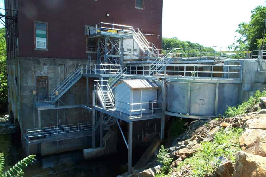
The entrance to the Tunnel Dam Fishlift is to the lower left behind the fern. Once crowded inward, fish are lifted by the hopper and released into the aluminum channel where they swim upstream to the right, passing the counting house. The eel pass is located underneath the stairs.